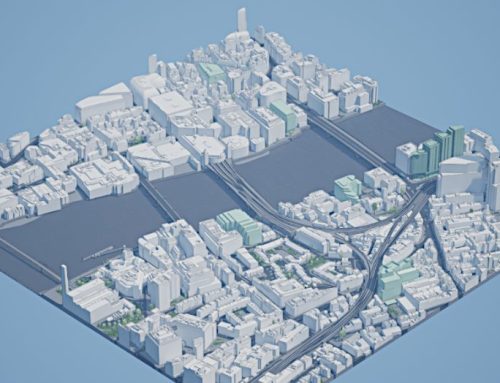
AccuCities provides 3D models of infrastructure for all kinds of studies and assessments. Our 3D maps are used for anything to do with infrastructure, from simple Visibility Analysis all the way to Glare and Wind Analysis. To give customers the opportunity to evaluate whether AccuCities 3D site models are the right solution for your project, here are two samples of 3D models of road and rail infrastructure.
Both the Road and Rail infrastructure project samples are available in AutoCad Solid DWG format, FBX, SketchUp SKP format as well as Revit RVT format.
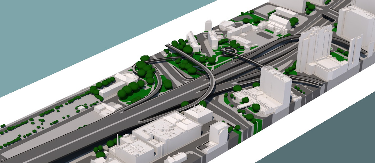
Road Infrastructure Sample: Glasgow M8 exits 18 and 19
This high-detail Level 3 model covers 0.256 km sq (see map mark-up https://bit.ly/46WNSc3 ). The model follows a stretch of the M8 motorway, including both banks of the River Clyde, as well as the St. Vincent Street crossing. Beyond the road itself, the dataset also incorporates adjacent terrain, buildings, and trees within a 100-meter buffer zone on either side of the motorway. This level of contextual information is particularly valuable for projects where the relationship between infrastructure and its surroundings plays a key role, such as assessing traffic impact, noise dispersion, or visual integration with the cityscape.
The 3D model has been produced in 7 working days for £1,280+VAT.


AccuCities® Rail Infrastructure Sample: North London
This high-detail Level 3 sample (see map mark-up https://bit.ly/46ly3eU )covers a linear 3D model of a railway between White Hart Lane and Edmonton Green in North London. The model covers 0.12 km2 and is a great example of speed of delivery and extent of a linear 3D map model.
The 3D model has been originally produced in 6 working days for £600+VAT. The model is captured from aerial imagery and is not suitable as a replacement for ultra-accurate laser scans, such as the ones routinely captured by Network Rail for inspections. The customer was conducting a glare analysis to simulate glare from the proposed building to understand whether it would affect the train driver. For this purpose we capture overhang signals and signal light structures as part of the Level 3 model.


Samples of AccuCities 3D Models of London
Make sure to download our free 1 km2 3D Model of London samples. Free download of CAD, FBX and OBJ samples of the high-detail 3D model of London. Textured Level 3 model samples also available in FBX format. Samples are available in both local and UK national grid coordinates. Samples of Custom models and 3D Models of more UK cities are available here.
How to Order a Custom 3D Models of Infrastructure Site
AccuCities 3D models of as-built environments are an industry standard for planning studies and analysis. Manually captured from the latest aerial survey, AccuCities 3D Models can be captured for a site anywhere in the UK with 15 cm accuracy. Georeferenced CAD models in DGW format overlay OS planning maps and can be used for Daylight, Sunlight & BRE, Overshadowing & Solar Glare, EIA Chapters, Envelope studies, Rights of Light, Cutback & profit share, Feasibility Studies, Verified Views and many other planning purposes. You can find more Customer Case Studies here.