AccuCities 3D site models are used in the workflow of many planning consultants. As providers of “Daylight” software, MBS Daylight offers unique collaboration with Architects, Developers and Consultants. They can be involved throughout the daylight design process, offering their client to tap into their consultancy service when required, saving both time and cost.
Facade Analysis
MBS can provide advice from the earliest stage of site layout, using Facade Analysis to help optimise both building orientation and window placement. At this stage a model of the surrounding buildings will be required in order to understand their impact on the design as well as the effect the proposal may have on its neighbours.
3D site model created from aerial photogrammetry is used initially. If a more accurate site survey is required – for example, for ROL purposes – then a 3d Laser Scan can be carried out. One of the advantages of using AccuCities 3D models is the speed of delivery of the site 3D model.

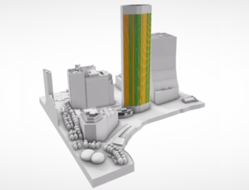
Sunlight To Amenity
Sunlight to amenity measures the amount of sunlight an amenity such as gardens and playgrounds receives on a typical date, usually March 21st. This study might be required as part of the planning process, especially when submitting planning applications for mid- to high-density developments.
To conduct the study, MBS requires AccuCities 3D model of proposed and surrounding buildings, exact geo-location and orientation (delivered as part of the 3D site model delivery) and accurate sun path calculations. Where existing model is in AccuCities library, the site model is delivered in less than a day. If custom model is required, the model is delivered in 6-7 working days.

Shadow Analysis
Shadow Analysis provides an indication of the daylight shadow casted by the proposed development on the neighbouring properties on a particular time and date. This is often a required component of planning applications for new developments, especially when tall buildings are proposed, there is close proximity to existing properties or when there are concerns about loss of light to gardens, public spaces, or neighboring windows.
3D site model created from aerial photogrammetry is used throughout the process, especially in combination with Future Skyline layer. Future Skyline layer is a set of 3D models of future developments. Where available, these 3D models are available to customers with every purchase.

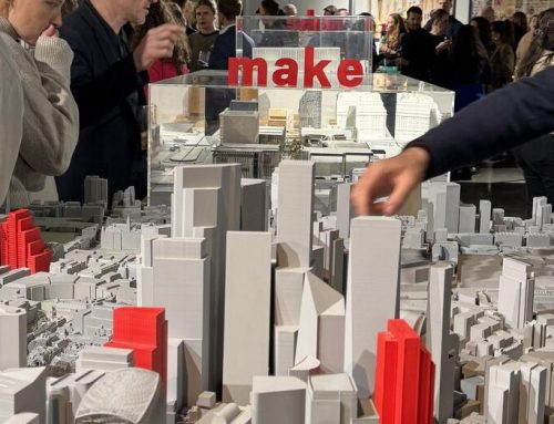
Accurate & Detailed 3D models for Planning
AccuCities is a specialist in providing accurate, detailed and up-to-date 3D site models for planning and architecture. Our 3D models can be custom-made using photogrammetry remote surveys, for any site in the United Kingdom and Ireland, in as little as 4 working days. For sites in cities in our 3D city models library, the delivery time is in just a few hours.
Read more: AccuCities Customer Case Studies