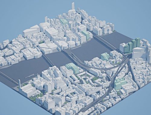
AccuCities, a London-based specialist in 3D city modeling, has been instrumental in delivering accurate, highly detailed and current models of London to the AEC industry. Up-to-date 3D city models are instrumental in conducting environmental analyses, such as pedestrian wind modelling, daylight, sunlight and overshadowing studies. To deliver 3D models customers can count on, AccuCities always use the latest available source data. To enhance our commitment to 3D city models currency even further, AccuCities provide Future Skyline Layer for areas of rapid development, such as City of London tower cluster.
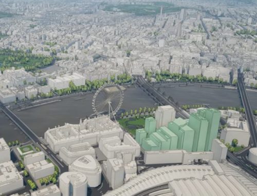
Changes in the City of London tower cluster
Future Skyline layer buildings are either 3D modelled by us from planning applications or sent to us by architects or developers. All of these proposals already have planning permission and although there might be further additions, this is how the London city skyline will look like in 2029.
Tile TQ3381 SW spans over a small 500 x 500 meters area of the city and neatly covers most of the City of London tower cluster. It is therefore a great illustration of the amount of change recorded in the 3 digital models captured by AccuCities in 2016, 2019 and 2022, as well as a peek into what is coming to the London skyline over the next few years.
Managing an Up-to-Date 3D London model
To create a 3D London model, every point and every line in AccuCities 3D city models is manually captured using stereo photogrammetry. Having a 5 or 10 year old city model is of a very limited use to planners and architects. No matter how accurately it was produced to begin with, if the building has been replaced 4 years ago you simply cannot rely on the model any longer. That is why we update and completely re-capture our 3D London model every time a new aerial imagery is available, with the view of the next 3D London overhaul this year or in 2026.
The investment to do this is of course significant but it gives our customers real competitive advantage. We understand that they need this reliable dataset and it is one of the reasons why 8 out of 10 customers buy from us repetitively.
Keeping the London Future Skyline Layer Up-to-Date
AccuCities regularly update the Future Skyline Layer. As there are no publicly available 3D models of future developments, assets in this database are created from planning applications plans, drawings and sometimes even from marketing renders. As our customer base grows, more and more architects are sending us their proposed developments so others can use them, enhancing the overall planning environment in London.
Up-to-Date 3D models for sites outside of London
Because we are an independent company, for sites outside of London, AccuCities always uses the latest aerial imagery from any of the UK suppliers. That means that our customers can always count on us to provide the most accurate and up-to-date 3D site information in one of two levels of detail. The models are supplied in the file formats used by the architecture and planning industry, including CAD, SketchUp, FBX and Revit formats