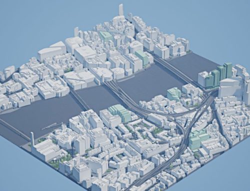
The mission of the Centre for Urban Science and Progress (CUSP) London is to support interdisciplinary research and innovation using Data Science in and for London. The centre brings together multi-disciplinary teams of academics, associates from external partners, and students working with CUSP London. King’s College London (KCL), the home of CUSP London, are subscribers to the AccuCities 3D Model of London. Subscription allows collaborators to exploit and visualise city data in the third dimension. And what they are doing with the data is truly awesome.
Visualising realistic lighting scenarios in Unreal Engine
Tools available within game engines, such as Unreal Engine, can help to obtain realistic lighting scenarios. By combining data from the London Borough of Camden alongside accurate 3D city data, CUSP London can consider how different lighting configurations might impact visibility at various locations. Unreal Engine can also enhance investigation into relationships between, for example, street lighting and crime rates.

Geodemographic classification in 3D London
This example shows four different views of a choropleth map overlaid on the AccuCities 3D London model. The data is a geodemographic classification of output areas in London using the 2021 UK Census, available from the Consumer Data Research Centre. This classifies each output area in London (a geographic area representing around 300 usual residents) into one of the seven categories depicted on the legend.
Visualising the data over the AccuCities 3D model offers additional context to a traditional two-dimensional choropleth map, particularly when considering how built environment factors, such as proximity to green space or the density of tall buildings, interacts with the classification depicted.

More understandable air quality data
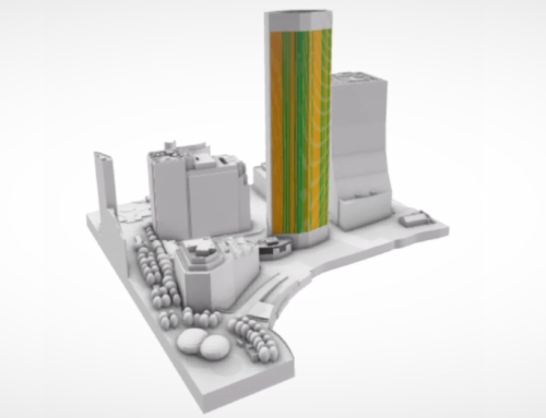
CUSP London have visualised air quality data from the Breathe London community sensing network. Air quality measurements are visualised using bivariate vizent glyphs. Within these glyphs, the colour reflects the current value, while the frequency of the black and white shape around the outside of the glyph represents variance from typical distributions. (This frequency could also be used to represent uncertainty within the measurement.)
In this example, we see a sensor with a significantly reduced PM2.5 measurement for the week of the 8th July when compared to the previous year average. The other sensors do not see such a large reduction. The 3D model environment allows users to explore the locations of sensors and their measurements within a familiar 3D context.

Learn more about AccuCities and CUSP London
AccuCities offers its city data in AutoCad solid format (.DWG), SketchUp format (.SKP) and of course the FilmBox (.FBX) format. .FBX is widely used to transfer 3D models between software packages such as 3D Studio Max or AutoDesk Maya, as well as in Unreal Engine project format. This flexibility makes it easy to use the dataset across many applications. The 3D model is licensed in various levels of detail and complexity, uniformly accurate to up to 15 cm across the dataset.
Learn more about the AccuCities 3D model of London.
CUSP London is a collaboration between King’s College London and New York University. It is a multi-disciplinary research centre that brings together researchers, businesses and government agencies. CUSP London apply data science and visual analytics to urban challenges, improving citizens’ lives, their health and their well-being. The creation of CUSP London follows the highly successful establishment of the Centre for Urban Science and Progress (CUSP) in New York. The two centres work in close collaboration on projects with global relevance.
Learn more about CUSP London. Or get in touch by emailing CUSP-London@KCL.ac.uk.