3D city models can be created using a variety of techniques, including Aerial Photogrammetry and Extruded Buildings Footprints. Extruding buildings footprint polygons is usually the fastest, most cost-effective way of creating a 3D city model. These 3D maps can give a better understanding of the as-built environment than 2D maps. However, the resulting 3D city model is often too generalised, with many important features omitted or simplified.
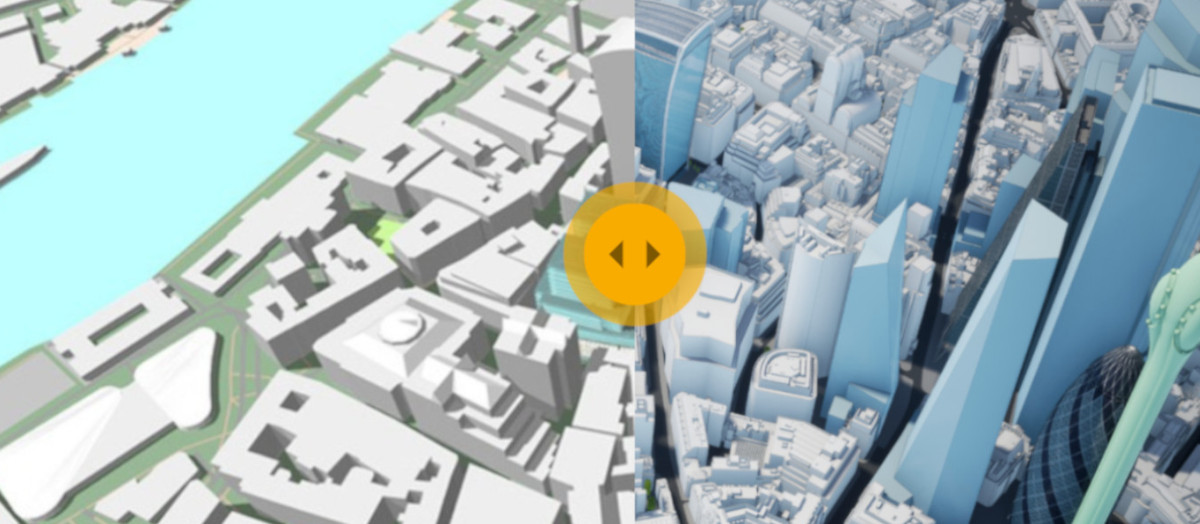
This lack of detail can result in a city model with many errors, clearly visible when we compare this model to a photogrammetry-captured model. See below for a direct comparison between a 3D model of Cardiff generated by extruding buildings footprints and AccuCities 3D model of Cardiff.


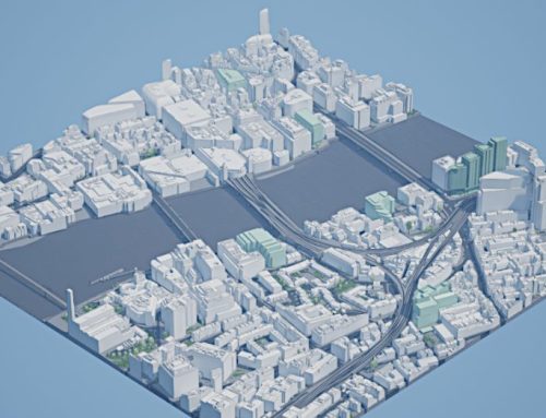
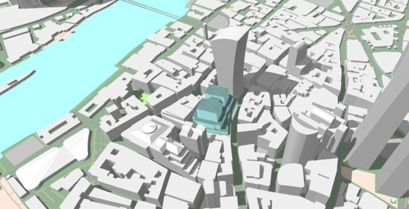
3D City Model from Extruded Buildings Footprints
In essence, the 3D model is created by taking an estimate of a building’s height (or taking an average building height value, if it exists) and extending the footprint vertically to that height. OpenStreetMap is a good example of this technique; OSM Buildings building data works with web maps, GIS applications, analysis tools and 3d visualisation and non-commercial map applications may use our data tiles free of charge.
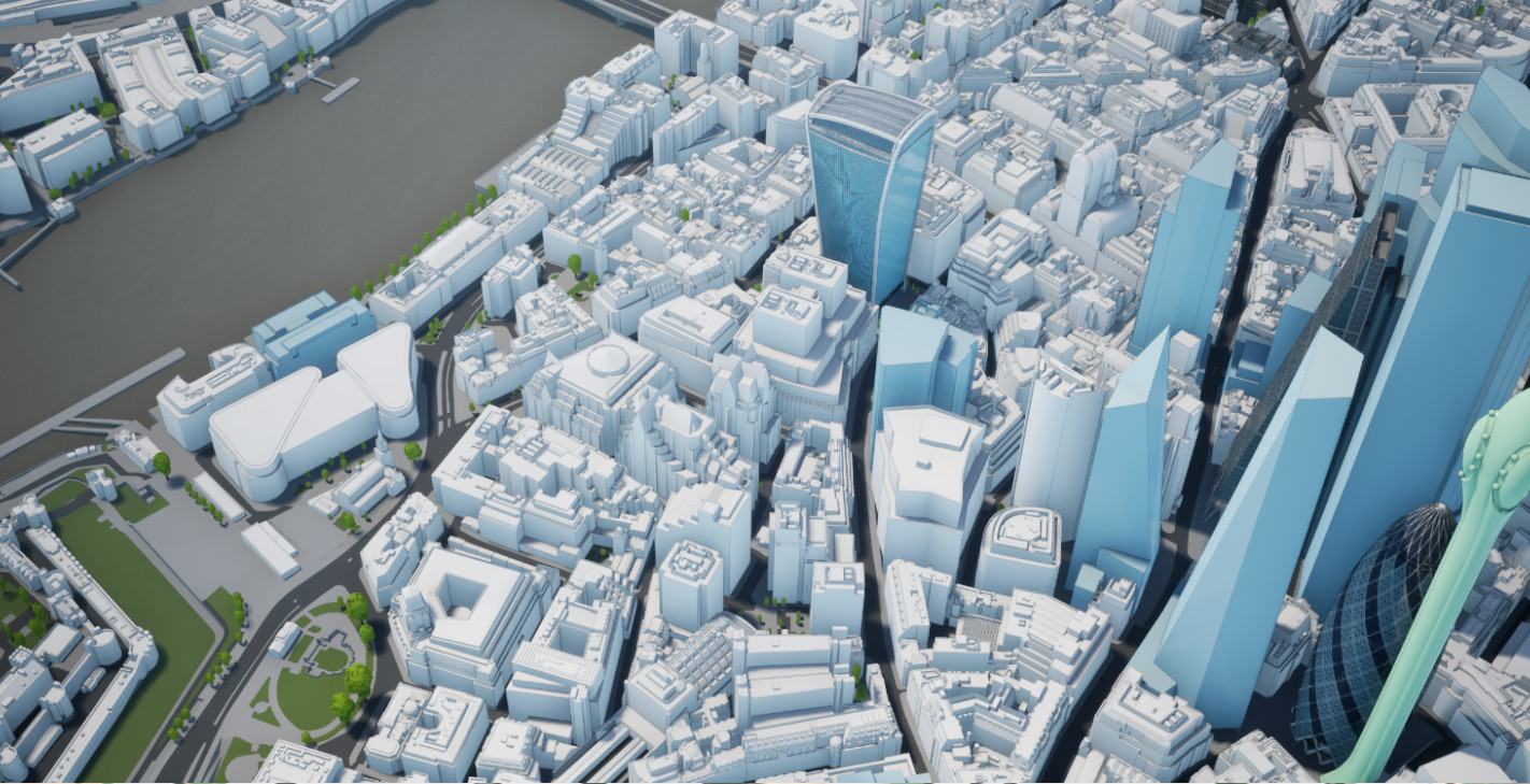
AccuCities 3D City Model from Aerial Photogrammetry Survey
In essence, as a survey plane flies over a city area, it takes series of photographs which overlap by 60%. With each photograph its GPS position, height, tilt, pitch and roll are recorded. Using this data + camera calibration data (to eliminate lens distortion effects), the imagery is triangulated to its correct real-world coordinates. Once the source aerial imagery is triangulated we can start the capture process. In areas where two images overlap, we project one image into one eye, the second image into another eye and and this way we are able to see the Z value (depth). Every point and every line in our 3D city models is manually captured using this technique.
3D city models in a Direct comparison
You can clearly see the major differences in the direct comparison above. Note the missing 3D model of the London Bridge and the discrepancies in the heights and shape of the buildings. Trees locations are also missing from the simple 3D model created by extruding buildings’ footprint polygons.
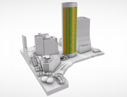
Another visual problem of these simple 3D city models is the inability to display a 3D shape that is not made of vertical faces. This is most noticeable on the 3D model of the Shard building (below). Even more concerning – and for much possible use in planning making this kind of dataset unusable – is the lack of terrain elevations. These are most prominent on the railway tracks elevations (or their lack-of) in the mapping 3D model is a critical feature omission. Simulating a pedestrian wind comfort or an area overshadowing is impossible with these kinds of 3D models.

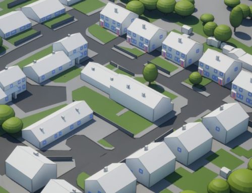
Custom 3D models of As-built Environment
AccuCities custom 3D models are captured from Aerial Photogrammetry Survey and our Custom capture service now covers 98.5% of United Kingdom. We source the latest aerial imagery source photographs and manually capture 3D models of cities and as-built environments anywhere in the United Kingdom or Ireland. See Custom 3D Models examples.
Rapid 5-day custom capture of CAD context models covering 330×330 meters of the as-built environment only £500+VAT. Use our Quoting Tool to send us your site mark-up.