Gela Pertusini from Royal Institution of Chartered Surveyors (RICS) magazine Modus explores why 3D mapping is a high-tech crystal ball for surveyors. Sandor explains how we capture Future Skyline layer and Michal gets all controversial about now shelved London’s Garden Bridge.
Building London’s Future Skyline layer
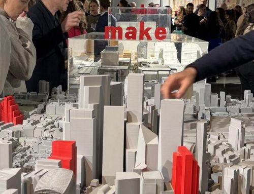
A 3D city model has obvious benefits to architects, urban planners and engineers (although it’s also used by the increasingly realistic gaming industry), with most big-name architectural practices among their users.
“All the stakeholders want to know what the area that they are designing in will look like when their building goes up and, with a big development, that might be in eight or 10 years,” says Sandor Petroczi, AccuCities Director. “There is currently no requirement by local authorities to provide 3D models, but our customers can see what will be there in a few years’ time. This matters really matters in a place like London, because it’s getting so crowded and the distance between buildings can be just a few metres.”
That is why AccuCities collects planning applications from London planning authorities and recreates each building from submitted information. These 3D models then form part of a Future Skyline layer, available to CAD city models customers as well as to Plan.City subscribers. Future Skyline layer works perfectly with our brand new Textured 3D London model.
3D city model – A double edge sword?
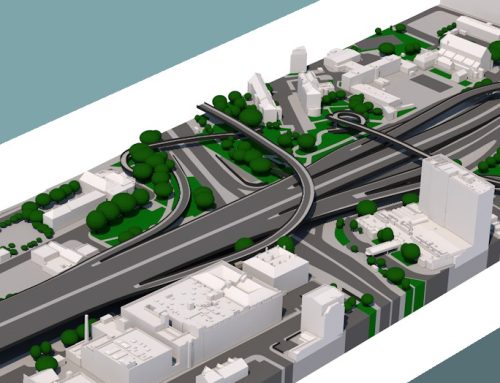
AccuCities manages 3D Model of London for variety of business customers including architects, urban planners and planning consultants but also for visual FX studios, 4D/5D planning, advertising agencies and content producers. But how city models they help city residents?
“You must have seen renders like the Garden Bridge which are quite subjective and always made the project look good,” says Michal Konicek. “With our model, there is much less room to hide, and some users do see it as a double-edged sword: they know that they will be scrutinised much more because they don’t have the privilege of choosing the angles. But most of our customers see this aspect as a welcome development, helping them to create better designs.”
Had the model been available during Boris Johnson’s tenure as Mayor of London, perhaps an awful lot of time and even more public funds could have been diverted from the failed Garden Bridge project – the wind modelling alone would have shown it was unfeasible.
Parts of this article originally appeared in Why 3D mapping is a high-tech crystal ball for surveyors.